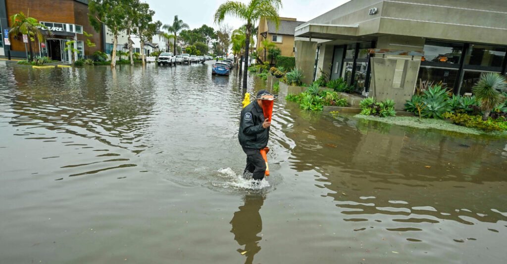
It could rain for days in Southern California starting Saturday afternoon, possibly in record amounts, creating the risk of what the National Weather Service described as “life-threatening flooding” Sunday through Monday.
The storm system is also expected to bring several feet of snow to the Sierra Nevada and strong onshore winds and strong, damaging surf along the California coast.
Here’s what you need to know.
-
The effects of this system will begin to be felt in California Saturday afternoon and last through Tuesday.
-
Heaviest rainfall is likely south of the Bay Area, and excessive rainfall is likely from Santa Barbara to Los Angeles.
-
There may be dangerous flash flooding in places. The Weather Service warned that, starting Sunday, the Los Angeles River “will fill up quickly and become a rushing river and a very dangerous place.”
-
There is an extremely high chance — more than 90 percent — of at least two feet of snow, especially above 6,000 feet in the Sierra Nevada, causing difficult to impossible driving conditions Sunday and Monday.
This atmospheric river will be stronger than the last two.
This storm will be associated with an atmospheric river, a stream of moisture in the sky that is typically a few hundred miles wide and can be seen in satellite images.
It will bring plenty of moisture from the tropics near Hawaii, and as it makes landfall, the mountains will wring moisture from the air like a wet towel, causing record rainfall to fall.
The angle and orientation of the mountains can have a big effect on how much precipitation can be generated by an atmospheric river, and this latest system will have a southwest-to-south orientation, hitting the transverse mountain ranges from Santa Barbara to Los Angeles in the perfect angle to create a worst case result.
Making matters worse are the warmer ocean temperatures just offshore.
“Anytime you have these amounts of precipitation intersecting with terrain and the built environment, you’re going to have a problem,” said Greg Carbin, the National Weather Service’s forecasting division chief.
Some of the heaviest rainfall could reach daily records of one or two days, Mr Carbin said.
Up to a foot of rain could fall.
This storm could drop “unprecedented” amounts of rain over a wide area – up to a foot in some locations in less than two days, the Weather Service said.
It has the potential, forecasters said, to rival or exceed the atmospheric river that led to rescues from flash flooding in Los Angeles last winter.
California Governor Gavin Newsom’s office he said late Friday that it was mobilizing 8,300 emergency responders and 21 rapid water rescue teams in preparation for the storm.
Also Friday, Santa Barbara County issued an evacuation warning for some residents living near waterways and areas affected by wildfires.
The Weather Service in Los Angeles advised people to avoid driving Sunday through Tuesday.
This storm is expected to be even stronger than the atmospheric river that hit the same area earlier this week and significantly stronger than the very weak storm that sent a torrent of water into San Diego last week. This storm strengthened because winds swept higher-than-average ocean temperatures.
In issuing its severe warning for the Los Angeles River, the Weather Service said flooding is possible in urban areas and other places with poor drainage.
Warmer than usual temperatures in the North Pacific waters will continue to be a factor with this atmospheric river.
The warmer ocean means more evaporation can take place in the lower atmosphere, which could translate to more rainfall on land, said Daniel Swain, a climatologist at the University of California, Los Angeles. on social media.
Martin Ralph, director of the Center for Western Weather and Water Extremes, said that “this atmospheric river will hit the area with winds almost directly across the mountains from Santa Barbara to Los Angeles and will flow through extremely warm coastal waters, adding moisture and heat which can increase rainfall over land.”
The atmospheric river alone would be problematic, but add in warmer ocean temperatures, the right angle to the mountains and the timing, following another storm system, causes forecasters to worry and use stronger than usual language, such as “a very dangerous situation.”
Mr Carbin said he believed there would be reports of mudslides, mudslides and road closures before the weekend was over.
Not everything is known with certainty, including exact locations.
As confident as forecasters are that this could develop into a major storm, there is still some hesitation in pinpointing exactly where the heaviest rain will fall.
“It’s still possible there will be some changes as the forecast comes into focus,” said Alex Lammers, warning coordination meteorologist at the Met Office.
A situation exists in which the main plume of heavy rainfall could remain over Santa Barbara and Ventura counties, increasing the risk of severe flooding in those areas and limiting the amount of rain that falls in Los Angeles County.
Rainfall totals will likely average three to six inches in most coastal and valley areas and six to 12 inches in the foothills and mountains.
“Even if urban areas don’t necessarily see the highest totals,” Mr Lamers said, “heavy bursts of rainfall can cause significant flooding impacts given the amount of cobbled terrain.”
Raymond Zhong and Emily Schmall contributed reporting.

